Ändern der Heightmap in Ultrascenery / Changing of
the heightmap in UltraScenery
Autor: Norman Richter auf Facebook. Beispiel / Example:
Vorbemerkungen:
Eine Heightmap ist eine 2-dimensionale Grafik, welche die verschiedenen
Höhenlevel in helleren und dunkleren Grautönen
abbildet. Diese werden hauptsächlich in der 3-D Computergrafik
eingesetzt um:
- Bump maps zu parametrisieren und dadurch eine nicht-glatte
Oberfläche zu imitieren
- Displacement maps zu parametrisieren und dadurch eine
nicht-glatte Oberfläche zu erzeugen
- ein Terrain zu erzeugen, dessen
Höheninformation (hier für UltraScenery) aus der
Karte gezogen und in ein 3D-Polygonnetz konvertiert wird
Weiß symbolisiert die maximale Höhe des Terrains, Schwarz die Minimale, also die Tiefen. Um
gute Hightmaps zu erzeugen, kann man Programme wie Wilbur nehmen, aber
meinstens reicht ein Grafikprogramm, dass Schwarz-Weiß-Grafiken
in Abstufungenn erzeugen kann. Zudem finden sich im Internet viele
brauchbare Heightmaps.
Preliminary remarks:
A heightmap is a 2-dimensional graphic that shows the different height
levels in lighter and darker gray tones. These are mainly used in 3D
computer graphics to:
* Parameterize bump maps and thereby imitate a non-smooth surface
* Parameterize displacement maps and thereby create a non-smooth surface
* to create a terrain whose height information
(here for UltraScenery) is pulled from the map and converted into a 3D
polygon mesh
White symbolizes the maximum height of the terrain, black the minimum,
i.e. the depths. To create good hightmaps you can use programs like
Wilbur, but in my opinion a graphics program that can create black and
white graphics in gradations is sufficient. There are also many useful
height maps on the Internet.
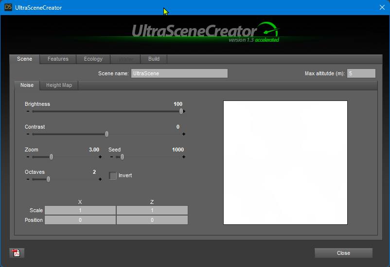
1. Ich stelle meine Map auf
nur Weiß. Dadurch wird eine ebene Fläche erzeugt.
Heightmaps müssen im PNG-24-Format erzeugt werden.
I set my map to just white. This creates a flat surface. Heightmaps must be created in PNG-24 format.
2. Als Beispiel wähle ich als Erstes den Dirt Track 1. First i am choosing the Dirt Track 1 for example:
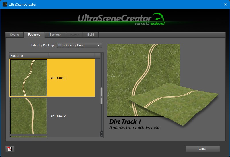
3. Der macht einen
Weg auf eine flache Karte. Wie gewünscht, sieht aber
blöd aus.
He makes a path onto a flat map. As requested, but looks stupid.
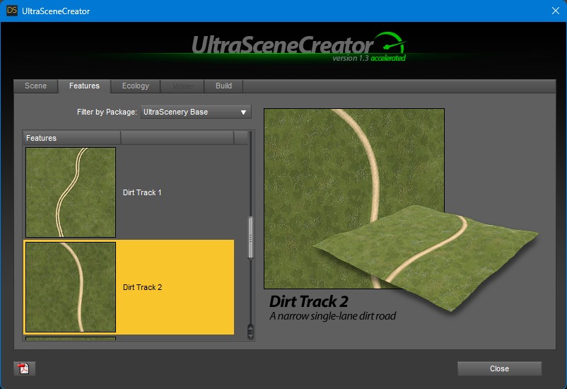
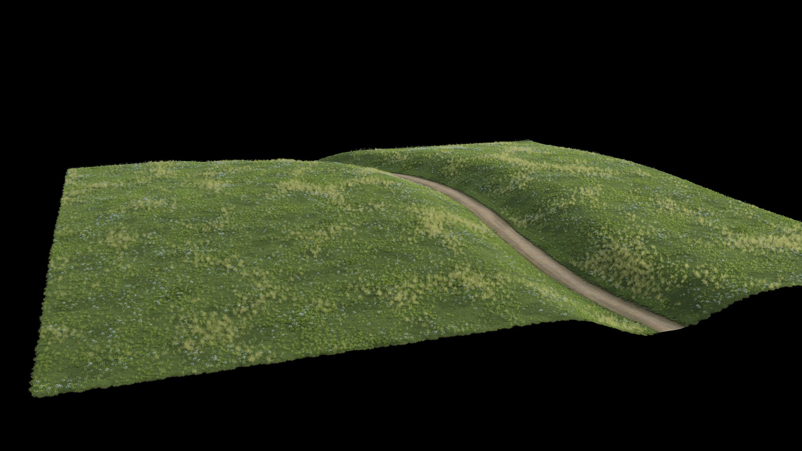
4. Jetzt nehmen wir aber den
Dirt Track 2.
Now we are choosing the Dirt Track 2:
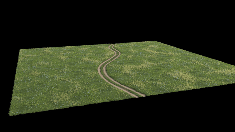
5. Der erzeugt im Hintergrund
mit einer internen Graustufenmap noch ein Tal für die
Straße. Ohne dass man irgendetwas anderes verstellt hat. Die
Graustufen Map war auch weiß.
It creates a valley for the road in the background using an internal
grayscale map. Without changing anything else. The grayscale map was
also white.
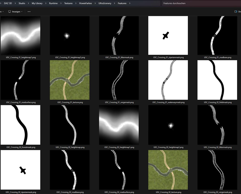
6. Solche Einstellungen gibt
es auch bei anderen Wegen und Straßen in US. Howies Maps dazu
liegen unter Runtime\Textures\HowieFarkes\UltraScenery\Features.
Such settings also exist on other paths and roads in the US. Howie's maps are located under Runtime\Textures\HowieFarkes\UltraScenery\Features.
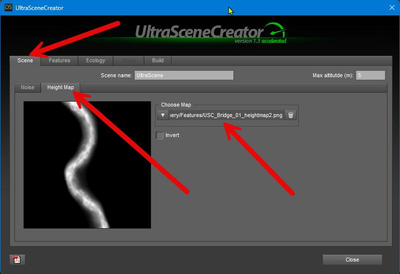
7. Man könnte ja
jetzt auch hingehen und die Maps aus dem Ordner benutzen, um seine
eigene Hügellandschaft zu erzeugen. (PNG-24-Format)
You could now go and use the maps from the folder to create your own hilly landscape. (PNG-24 format).
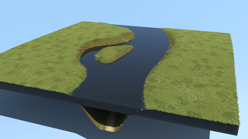
8. Endresultat: / Endresult:
Zurück / Back